See the whole community. Act on what matters.
One place for a community to understand its people, places, infrastructure, work and knowledge — and help the right people act on what matters. Mapsys connects that information without taking control of it away from the community.
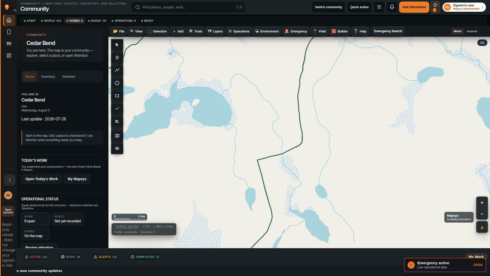
Communities don't lack information. They lack a way to keep it connected.
Important information often lives in spreadsheets, paper files, individual computers, phones, maps, engineering drawings, staff knowledge, contractors, separate departments and separate software. Each piece can be accurate. Too often, none of them know about the others.
People cannot easily find what they need. Knowledge can leave when staff change. Departments can work from different information. Field notes can take too long to reach the right person. Leadership can struggle to see what actually needs attention. In an emergency, the picture may have to be rebuilt under pressure. Community members may have useful knowledge without a safe, controlled way to contribute it.
Mapsys is here to reduce fragmentation and repeated work — not to replace the people who already keep the community going.
Information spread across files, maps, departments, people and systems.
Finding the right answer can mean asking several people, opening several folders, and still not being sure which version is current.
Information becomes connected to the people and places it belongs to.
Communities do not have to abandon every existing system on day one. Mapsys can start with the work that matters now, and connect more over time.
Mapsys is broad because a community is broad.
A community is not expected to learn or use everything in Mapsys. Different people use the parts relevant to their work and life. Mapsys connects the information without forcing everyone into the same workflow.
See what needs attention
Leadership does not need to operate the water tools. They need a clear picture of what is happening and what requires a decision.
Work from the places you already know
A housing worker does not need to run emergency coordination. They need the building, the work, and the people connected to it.
Keep knowledge with the person who holds it
A community member does not need administrative tools. They need a safe place for photos, places, tracks and knowledge that stays theirs until they choose otherwise.
Use what the community already knows
When something is urgent, people should not have to rebuild the picture from scratch. Mapsys can support authorized work with information that already belongs to people and places.
A Chief does not need to learn the water system tools. A housing worker does not need to operate emergency coordination. A community member does not need administrative tools.
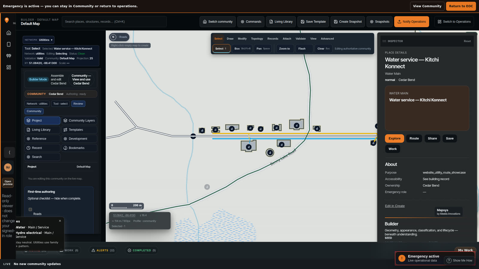
Open a place. See the information that belongs there.
Mapsys connects information to real places. Search for a building, a road, a water asset, a community facility, a Project, or another known place — then open it and see what belongs there.
- Why this place exists
- Who is responsible for it
- How people actually reach it
- What it becomes during a response
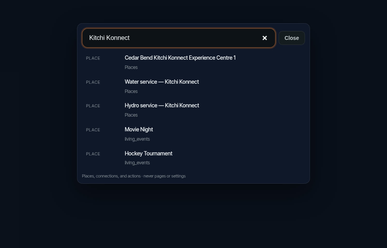
Type a name. Get the place — and what serves it.
Searching one building can also surface the water service and the hydro service feeding it, because those things belong together in the same community picture.
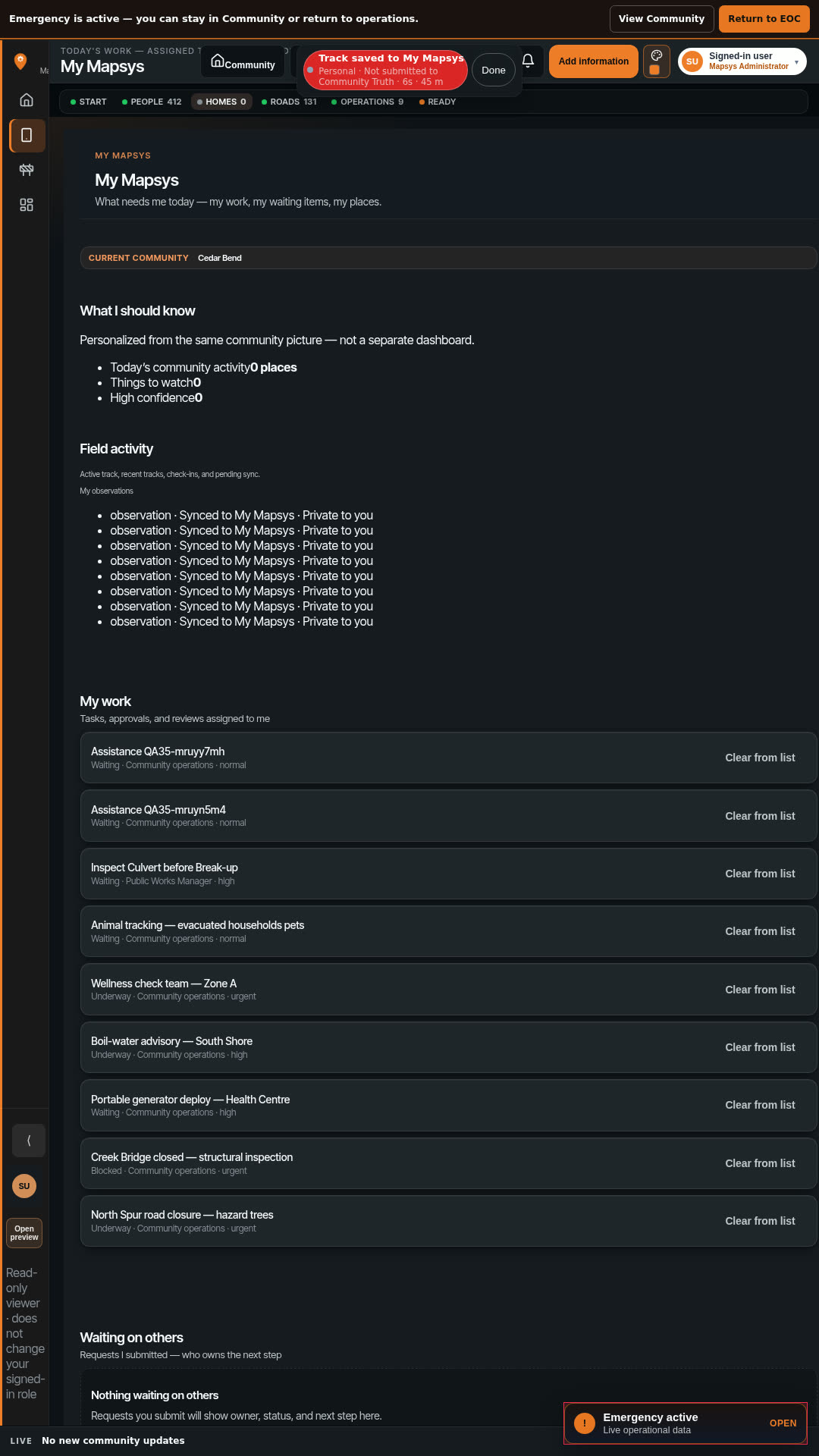
Mapsys starts with the person.
Every community member can have their own Mapsys experience. Personal information remains personal unless the person chooses an appropriate sharing or contribution action.
- Personal places
- Photos
- Journal
- Field knowledge and tracks
- Groups
- Projects they participate in
- Community information they are allowed to see
Using Community Mapsys does not automatically turn someone's personal information into community information.
People already organize. Groups give them a controlled place to work together.
Families, land activities, hunting and fishing, volunteer teams, local initiatives and custom groups already exist. Mapsys Groups let people share selected information with the people they choose — without turning that work into a public feed.
- Family
- Land activities
- Hunting and fishing
- Volunteer teams
- Local initiatives
- Custom groups
Sharing with a Group does not automatically add something to Community information. Groups are for working together, not for engagement metrics, followers, or social-media feeds.
Collect the work in one place — without automatically changing official community information.
A Project gives people a defined place to gather information and work together. When the work is ready, authorized people can submit the appropriate information onward.
Infrastructure inspection
Trail survey
Housing assessment
Land-use work
Emergency preparation
Community initiative
- Create the Project
- Choose who is involved
- Collect information
- Review contributions
- Complete the work
- Submit appropriate information onward when authorized
The map is how you see the work. The work is still the work.
Mapsys can support the actual work around community places and infrastructure — housing, roads, water, public works, assets, energy, communications, land use, inspections, incidents, maintenance and community attention. Every department does not have to adopt everything at once.
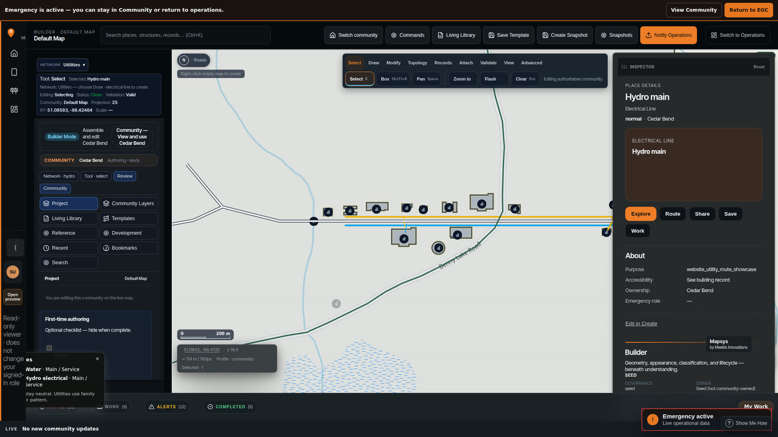
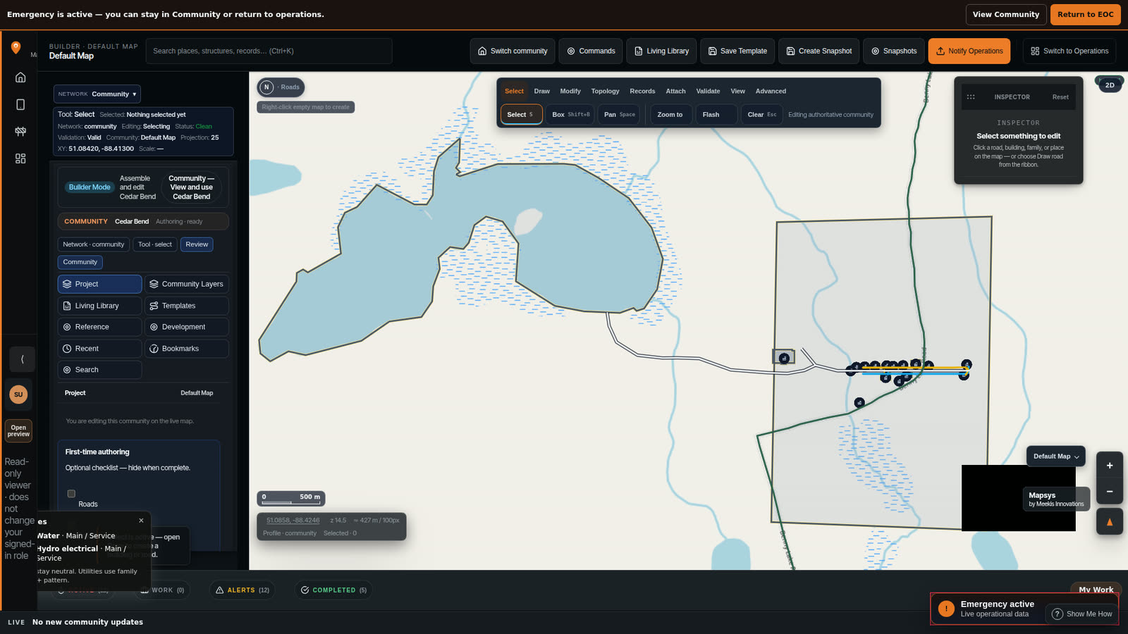
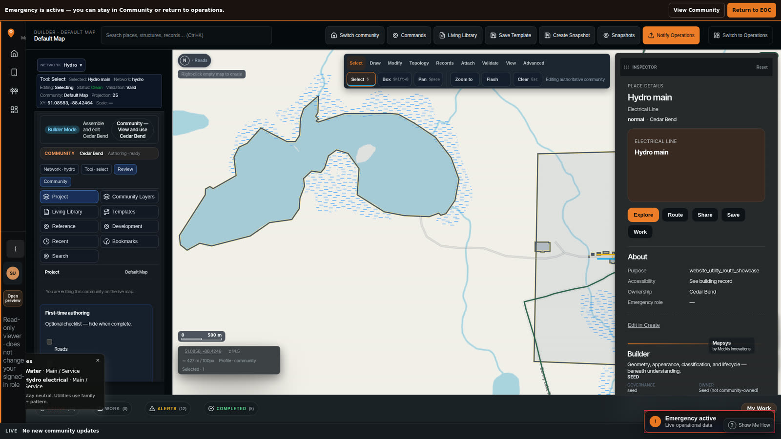
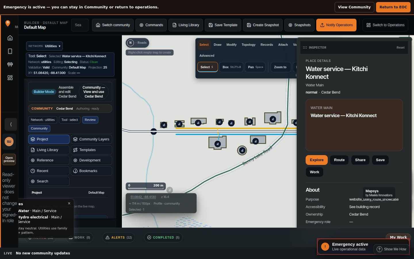
Follow the service from the road into the building it feeds.
The main in the road and the room on the far side of the wall are the same story. Following it end to end is what turns infrastructure information into an answer.
The routes shown are demo-authored on the Cedar Bend showcase community — a working continuity demonstration, not a certified utility as-built.
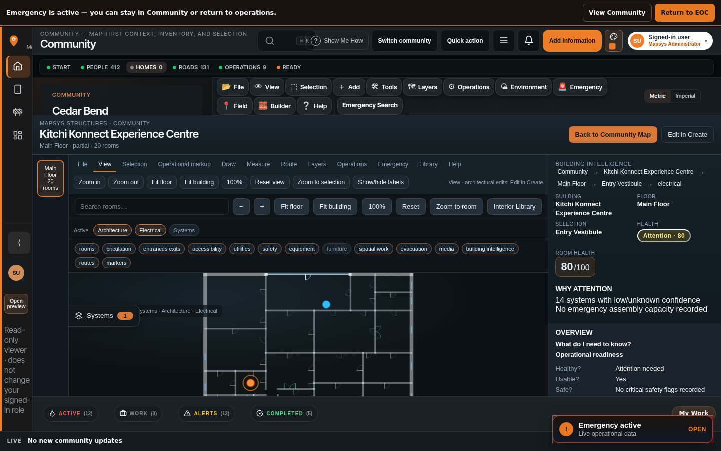
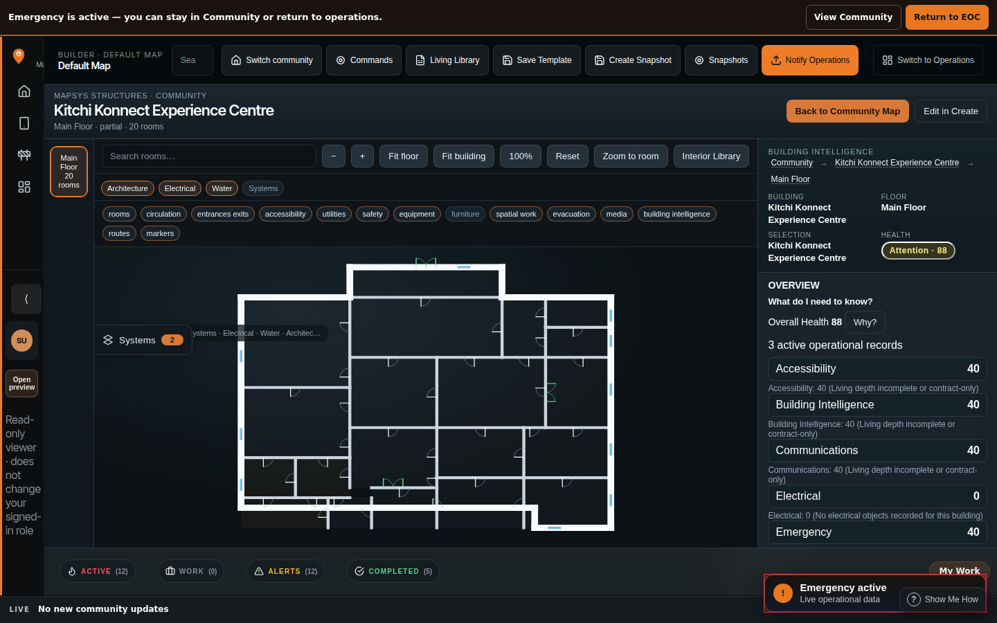
A building should be able to explain itself.
A building can become more than a point on a map. Mapsys can connect rooms, systems, assets, observations, maintenance information and relevant records — so the place is not a dot, a spreadsheet row and a folder somewhere else.
What is shown is the building opened into rooms and systems with its own condition and reason for attention. Full engineering-grade electrical documentation and certified as-builts are not claimed.
Mapsys supports real-device field use.
Mapsys has been used and accepted on a physical Android device. People can carry My Mapsys, field capture, Easy Track, photos and location-aware tools into the work — not only into an office screen.
Mapsys is designed to keep field work resilient when connectivity is poor, with offline-capable field workflows continuing to expand. Universal offline basemap coverage and “Mapsys works completely offline” are not claimed.
Report a concern. Keep the handling protected.
Members can report a safety concern through Mapsys. Authorized community staff can handle Safety information in a protected community workspace. Safety information is not a public suspect tracker, and Mapsys does not claim public safety authority it does not have.
- A community member can raise a safety concern
- Authorized staff can work with that information in a protected workspace
- It is not a public list of people
- It does not replace police, fire, or other authorities
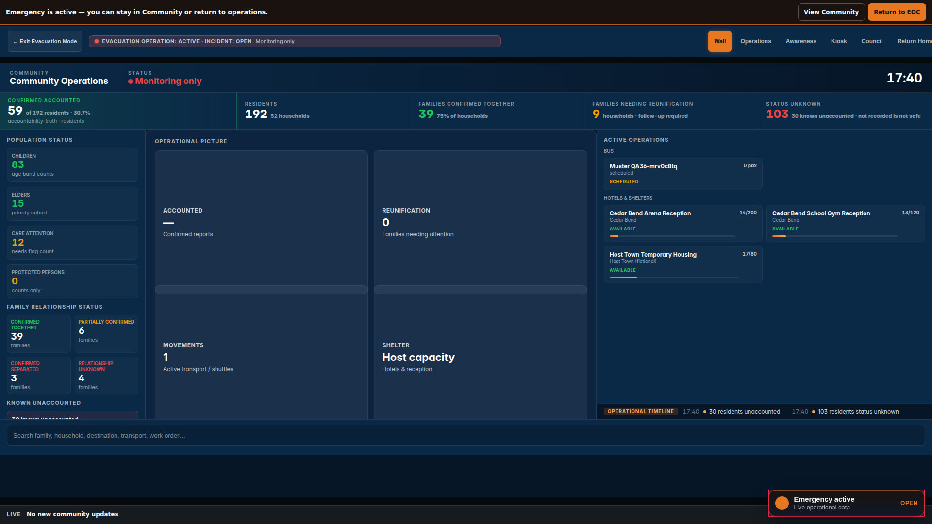
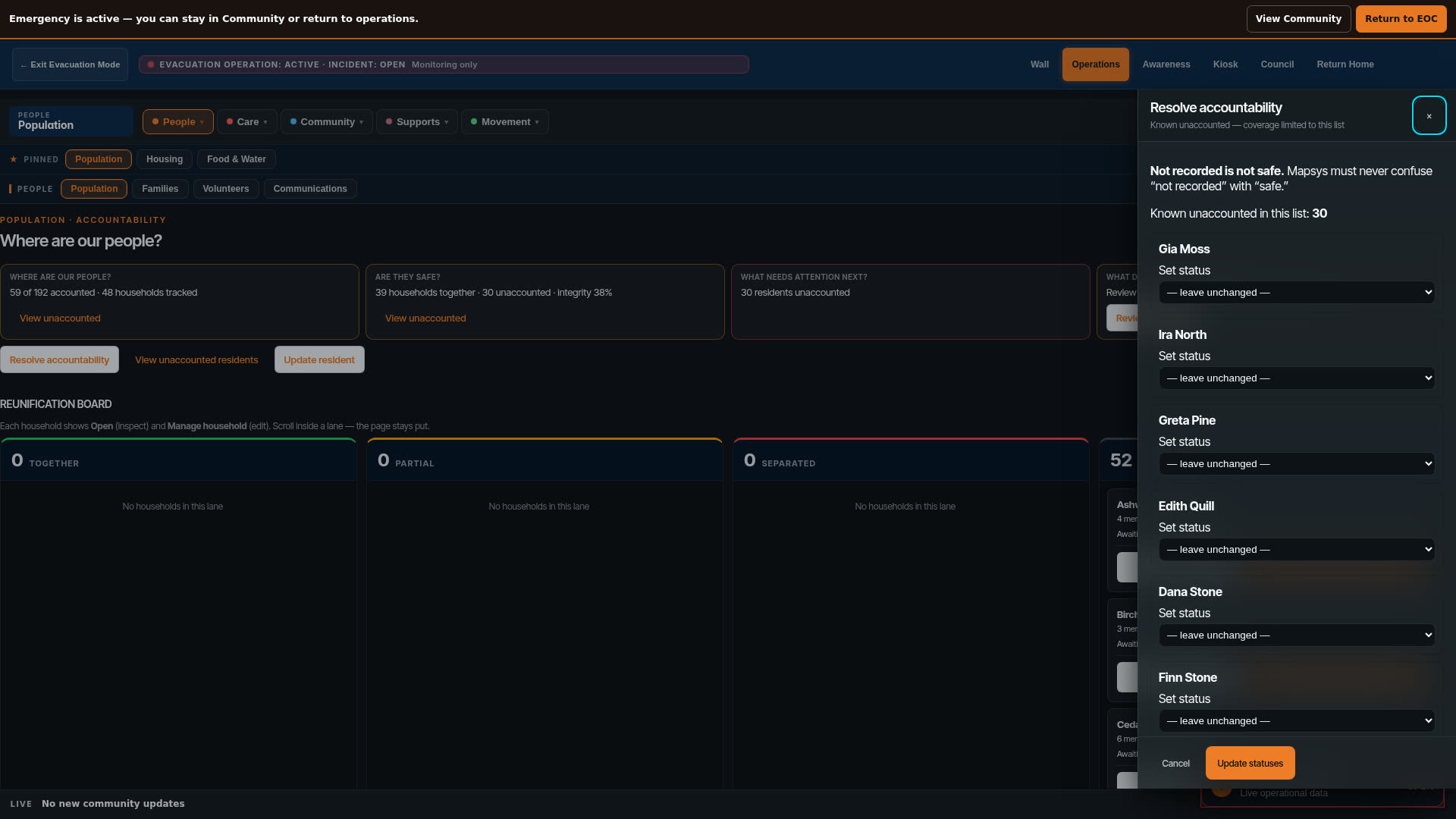
When an evacuation starts, the coordination shouldn't.
Emergency coordination should not begin when the evacuation begins. The same community information used day-to-day — people, places, facilities, roads and operational information — can support authorized emergency work when needed.
- People and accountability
- Places and facilities
- Roads and movement
- Hosts and accommodations
- Changing conditions
- Return planning
Mapsys does not replace emergency authorities. Demonstration captures on this page are not live operational truth.
Understand a building before the finished drawings arrive.
Create is the building design studio — not general map editing. Start from intent, from a template, from a capture of a building that already exists, or from an imported model, then work through spaces and requirements.
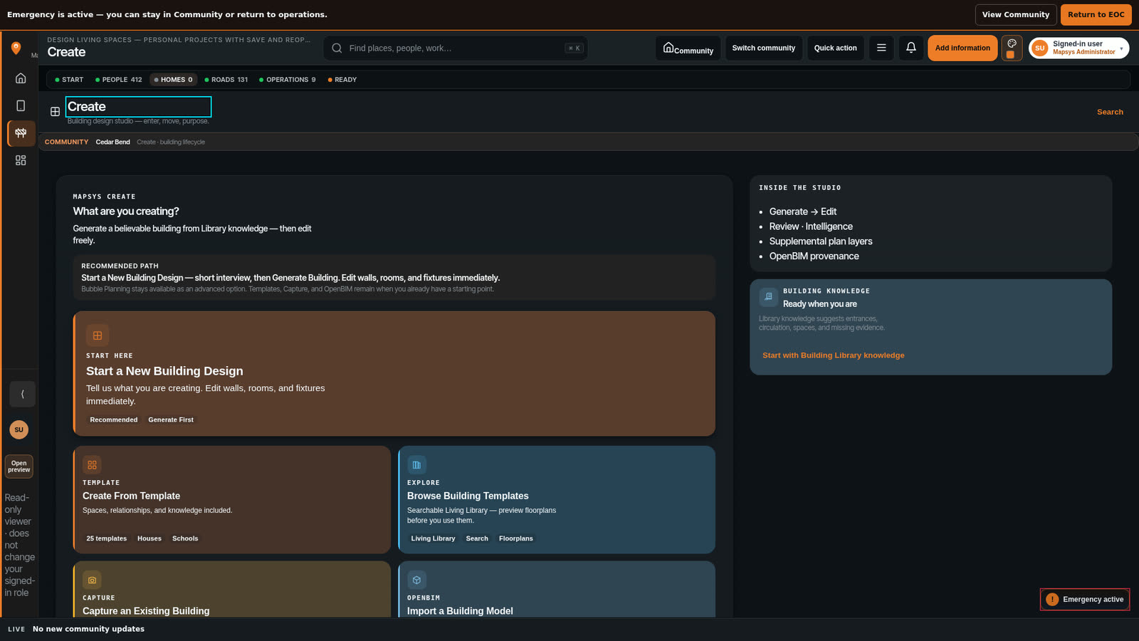
A community that can describe what it needs — in space, not adjectives — works differently with architects, engineers, funders and consultants. The conversation starts from something real.
What you build in Create can become the building information the community keeps afterwards. Create is not collapsed into everyday map editing.
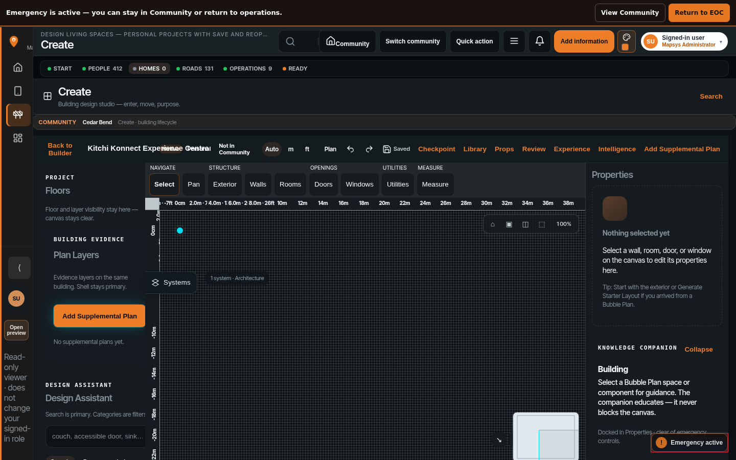
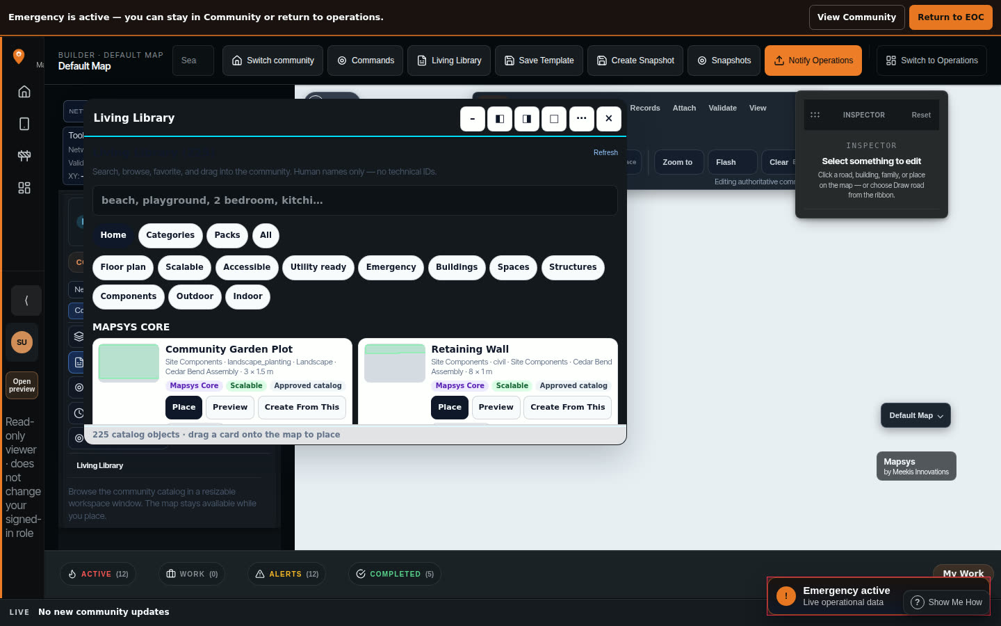
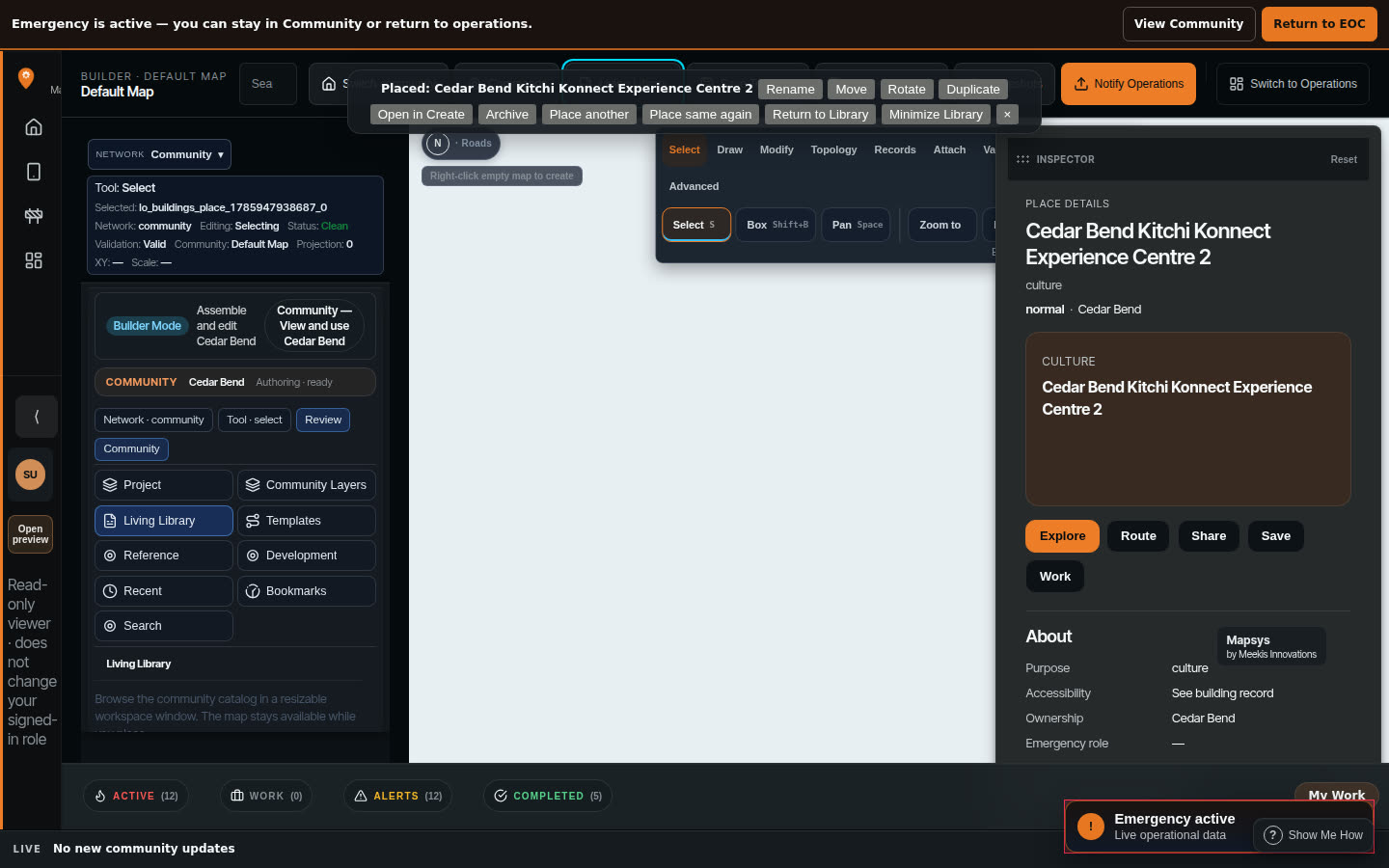
- 01Bubble plan
- 02Walls appear
- 03Doors snap in
- 04Building completes
- 05In the community
Step 01
Start from what a space is for.
Scroll to follow the transformation
Diagram, not a product screenshot. It explains the sequence from intent to a building on the community map. The capture above shows a definition placed through the supported action.
People and communities should know where information is going.
Where appropriate, Mapsys uses understandable choices. Exact choices depend on the information and the person's authority. Community authority remains with the community.
- Sharing with a Group does not automatically add something to Community
- Working in a Project does not automatically change Community information
- Personal information does not automatically become Community information
Stays with the person.
Goes to a chosen group — not automatically to the whole community.
Goes to people working on that Project.
Offered to community information, when the person has the authority to do so.
Shared more widely, only when that choice is appropriate.
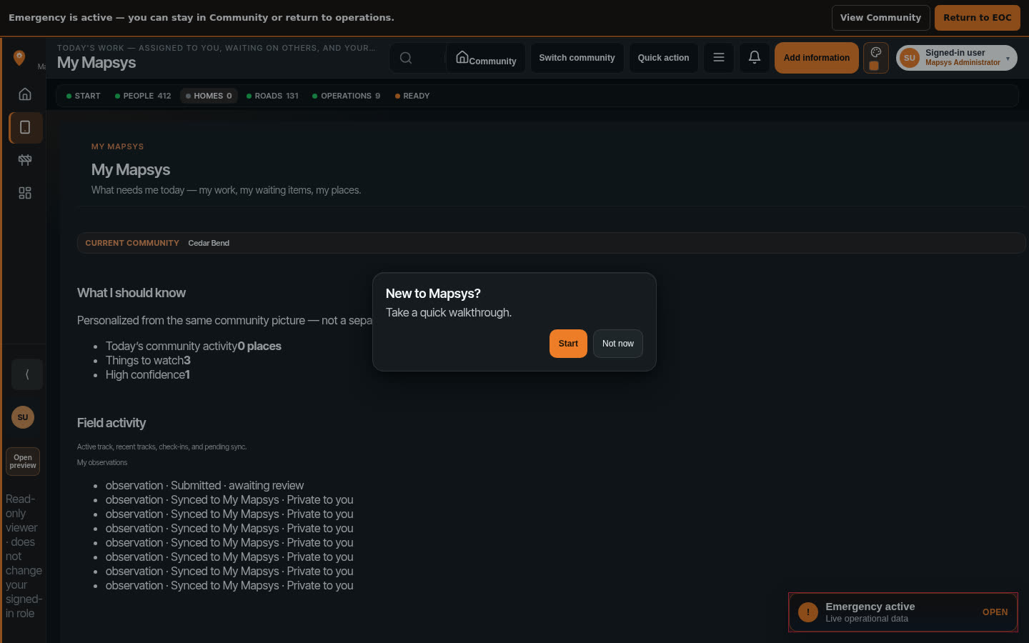
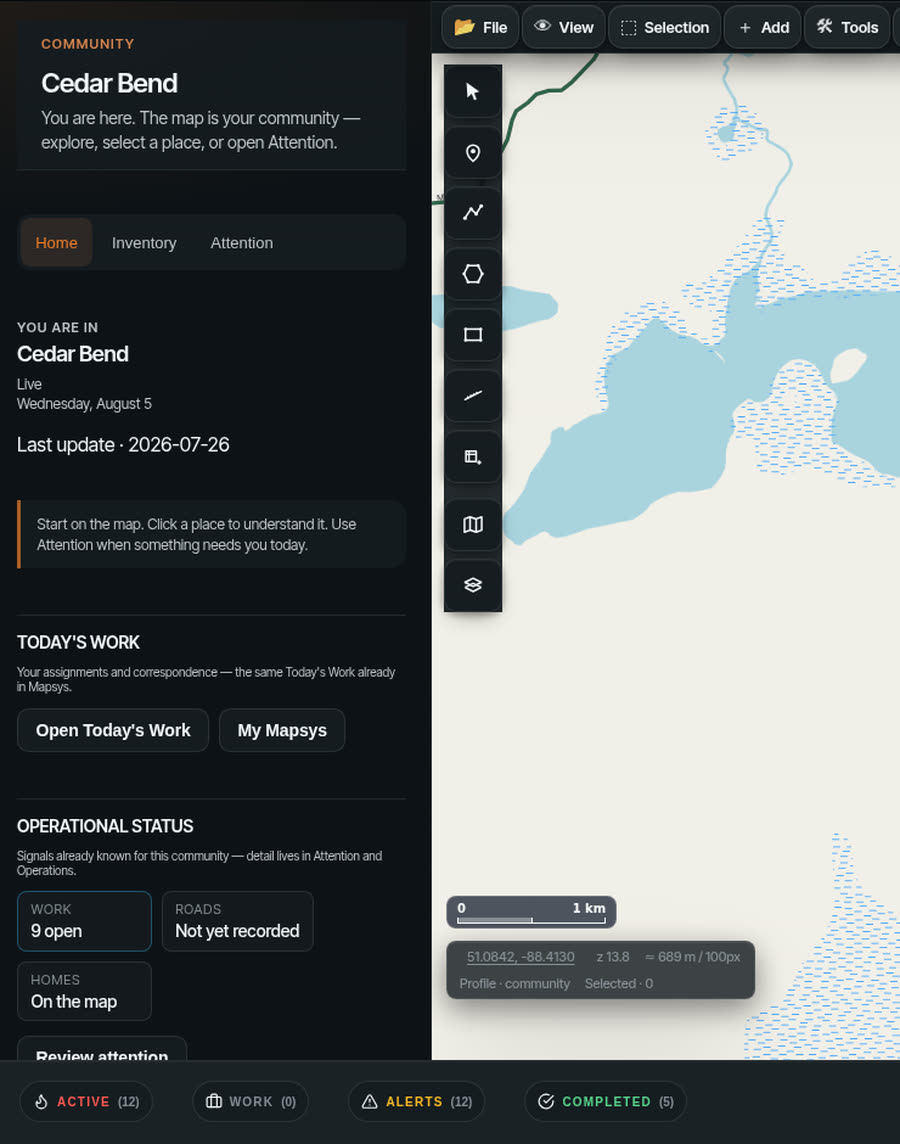
Understand what needs attention — without asking six people first.
Leadership should be able to understand what is happening around the community, what work exists, and where relevant information belongs. Leadership does not see private personal information merely because they are leadership.
- What currently needs attention
- What is happening around the community
- What work exists
- Where relevant information belongs
“Needs you” means something currently requires that person's action or valid responsibility. It is not a generic inventory count.
What Mapsys can show today — and what we do not claim.
Every claim on this page is either backed by a product capture above, by accepted Mapsys work, or listed here as not claimed. Nothing on this site is a rendered mock-up of Mapsys.
- See the whole community on one mapWorking now
- Search and open a placeWorking now
- My Mapsys on a physical Android deviceWorking now
- Easy Track, Journal, photos, Groups and ProjectsWorking now
- Water and hydro on one community mapWorking now
- Buildings opened into rooms and systemsWorking now
- Community Safety reporting and protected handlingWorking / continuing to expand
- Field work when connectivity is poorWorking / continuing to expand
- Emergency and evacuation coordinationWorking / continuing to expand
- Create a building from intentWorking / continuing to expand
- Follow a service from the road into a buildingWorking / continuing to expand
- Complete offline Mapsys / universal offline basemapsNot claimed
- Certified utility as-builts or engineering drawingsNot claimed
- Replacing emergency authoritiesNot claimed
Product captures from preview.mapsys.ca · Cedar Bend showcase community. Physical Android Mapsys use accepted in later Mapsys work. This ledger is for credibility, not a test log.
Need help funding the work?
Mapsys helps communities understand the work. FundOpps helps organizations find funding opportunities that may help pay for it.
Mapsys customers can also use FundOpps to identify relevant funding opportunities. FundOpps is a separate product — not a Mapsys module. It does not guarantee eligibility or funding.
FundOpps — a Meekis Innovations product
See what Mapsys could look like for your community.
Start with the problems that matter now — housing, roads, water, safety, field work, or emergency readiness. A community does not need to take on every Mapsys capability at once.